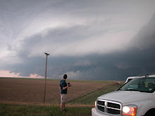
 This shot is pretty perfect aside from that darn telephone pole. 5/5
This is the closest we came to a tornado the whole time. This is a wall cloud associated with the squall line in southern Kansas on 5/6.

Mammatus after the squall completely crapped out (near Witchita). 5/6
 This was taken as we were being pulled over. We were hauling ass to catch up to this storm and payed the price. The storm went on to produce tornadoes near Phillipsburg Kansas. We caught up with the storm near Smith Center after dark but observed no tornadoes. We hunkered down in Bellevile Kansas with a close eye on the rader as we were surrounded by tornadic supercells. The Greensburg storm approached our position around 4 in the morning and woke me up with a n insane lightning show. I watched a weak meso pass our location just to the east on the radar and quickly got back to bed. This was a pretty freaky night. 5/4


1 comment:
Post the ticket of STFU!
By the way, I owe you a beer.
Post a Comment