In other news, it appears we are in for some heavy snow here in Western Littleton. I'm looking for 15-20 inches here at the house before all is set and done. I will possibly be shooting some heavy snow action tomorrow. Look for winter weather updates.
Thursday, March 26, 2009
Belated 3/23 Chase Report
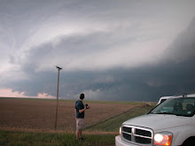
We had a nice cloudy drive to Wichita on Sunday and woke up in the target area Monday morning. We intercepted our first supercell near Kingman, Ks but it quickly left us in the dust as it appeared to be on the verge of tornadoing somewhere near Cheney Reservoir. We drove back to Wichita and south on I-35 as storms were beginning to erupt in northern Oklahoma way too early. We got position on the dominant supercell just east of South Haven, Ks. The storm was rather elongated but managed to produce a few brief tornadoes. Overall, the setup failed to meet our expectations but we had a nice go of it for the first chase of 2009.


In other news, it appears we are in for some heavy snow here in Western Littleton. I'm looking for 15-20 inches here at the house before all is set and done. I will possibly be shooting some heavy snow action tomorrow. Look for winter weather updates.
In other news, it appears we are in for some heavy snow here in Western Littleton. I'm looking for 15-20 inches here at the house before all is set and done. I will possibly be shooting some heavy snow action tomorrow. Look for winter weather updates.
Sunday, March 22, 2009
Plan for Monday!
Had a nice cloudy drive to Wichita this afternoon. It doesnt look like we will have to go far for tomorrow's setup. Nice 100kt upper jet and a 70kt mid jet = pure forcing! Anything on the dryline will be spinning like hell. Upper 50s dews look just fine with the shear, and 1km SRH around 250 looks good for a possibility of strong tornadoes. We have a few guests on this trip and we are looking forward to sharing their first tornadoes tomorrow evening. As always, we wish a safe day to all who chase or reside in the path of these storms.
OMFG!

OMFG!
Sundays Target is Garden City
The RUC paints a nice CAPE bullseye near the Garden City area by 0z. The H5 impulse will be early and may cause subsudence in its wake, but hopefully, storms will manage to fire. Any storm that goes up in this area will have a good chance of becoming a supercell. Expectations are not high but we may get a nice storm near sunset. Updates coming after the chase.
Wednesday, March 18, 2009
New Video From June 12, 2008
Jon Merage just put this great video on YouTube for our viewing pleasure.
Also, it appears that Monday has some serious tornado potential as a strong negative tilted trough enters the plains. I'm going to wait for a couple more model runs before doing a forecast. So far, I see a few issues regarding cloud cover and surface heating. otherwise, we have great shear and upper support for a significant severe weather event.
SMM
Monday, March 16, 2009
The Solution?
This isn't quite wide enough on a 1.6x crop camera such as my 30D, but on a 5D, it would be an ultra-wide. One could tilt the focus plane and be shooting Very Sharp Lightning at F/3.5, regardless of the distance from the camera. The Canon TS-E 24L doesn't have autofocus, but who uses AF at night anyway? This along with the newly released, albeit expensive TS-E 17L, present real, mostly overlooked options for the Low-Light Stormscape photographer. I'm curious to hear about other stormchaser's experiences with these lenses. For $800 used, I might just have to pick one up.
A cool article can be found here if anyone wants to read up on the advantages of TS lenses.
Friday, March 13, 2009
A New Look
Bigger is better right? From here on out, my photos will be posted in GRANDE size! A few more changes are also upcoming before terrorizing the Great Plains in a few weeks. Consider this blog Under Construction!

Thursday, March 12, 2009
Twittering Through the Storm Season
Hey everyone. Sorry for the long period of silence. I havent had a whole lot going on aside from busting my butt at work, saving for stormchasing. Im setting up a Twitter account for real-time updates during the entire storm season. Ill see if I can get this thing to post directly to my blog but for now, updates will be sent to this location- http://twitter.com/SeanMMullins. Look for more updates in the coming weeks.
SMM
SMM
Subscribe to:
Posts (Atom)

