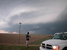
Jon Merage just put this great video on YouTube for our viewing pleasure.
Also, it appears that Monday has some serious tornado potential as a strong negative tilted trough enters the plains. I'm going to wait for a couple more model runs before doing a forecast. So far, I see a few issues regarding cloud cover and surface heating. otherwise, we have great shear and upper support for a significant severe weather event.
SMM
Wednesday, March 18, 2009
Subscribe to:
Post Comments (Atom)


1 comment:
Yea on twisterdata.com they have a simulated radar and it is probably 75-80% accurate and it has an isolated beast track along I80 around sunset well into the night on Sunday. Yea we will probably blast south to for Monday. Every model run except the GFS has the system slowed. The NAM has it still in Cali at 6z Sun and the GFS has it already plowing into the Plains at 6z.
Post a Comment