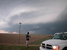
This weekend's potetential severe weather event has me pretty stoked. Oviously the weekend timing is convenient considering my work and school schedule.
A 35-40 Kt LLJ gets cranking with backing winds near the dryline. Hopefully the surface winds will back more than what is depicted here.  The 700mb temps show the cap eroding nicely.

 The 700mb temps show the cap eroding nicely.
The GFS shows a decent toungue of surface based CAPE. I would like to see this increased but 2000 sb CAPE would be good enough to feed some solid updrafts.


A reasonably sharp dryline is depicted here with solid mid 50's dewpoints to the east.


I suppose this is a good sign when the GFS breaks out precip along the dryline 132 hours out. 


No comments:
Post a Comment