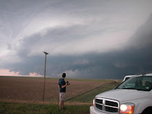
Jon Merage just put this great video on YouTube for our viewing pleasure.
Also, it appears that Monday has some serious tornado potential as a strong negative tilted trough enters the plains. I'm going to wait for a couple more model runs before doing a forecast. So far, I see a few issues regarding cloud cover and surface heating. otherwise, we have great shear and upper support for a significant severe weather event.
SMM
Wednesday, March 18, 2009

Monday, March 16, 2009
The Solution?

This isn't quite wide enough on a 1.6x crop camera such as my 30D, but on a 5D, it would be an ultra-wide. One could tilt the focus plane and be shooting Very Sharp Lightning at F/3.5, regardless of the distance from the camera. The Canon TS-E 24L doesn't have autofocus, but who uses AF at night anyway? This along with the newly released, albeit expensive TS-E 17L, present real, mostly overlooked options for the Low-Light Stormscape photographer. I'm curious to hear about other stormchaser's experiences with these lenses. For $800 used, I might just have to pick one up.
A cool article can be found here if anyone wants to read up on the advantages of TS lenses.
Friday, March 13, 2009
A New Look
Bigger is better right? From here on out, my photos will be posted in GRANDE size! A few more changes are also upcoming before terrorizing the Great Plains in a few weeks. Consider this blog Under Construction!

Thursday, March 12, 2009
Twittering Through the Storm Season
Hey everyone. Sorry for the long period of silence. I havent had a whole lot going on aside from busting my butt at work, saving for stormchasing. Im setting up a Twitter account for real-time updates during the entire storm season. Ill see if I can get this thing to post directly to my blog but for now, updates will be sent to this location- http://twitter.com/SeanMMullins. Look for more updates in the coming weeks.
SMM
SMM
Thursday, February 12, 2009
Retarded Sigma Lens!
Well, I saw that this was released a few months ago but have yet to see a review until tonight. Seriously crazy stuff! Doesn't look that huge next to a Canon 600L.

Check out this link for the review if you are so inclined.
http://www.juzaphoto.com/eng/articles/sigma_200-500_2_8_ex_dg_review_test_hands_on.htm
In other funny shit...

Check out this link for the review if you are so inclined.
http://www.juzaphoto.com/eng/articles/sigma_200-500_2_8_ex_dg_review_test_hands_on.htm
In other funny shit...
Wednesday, February 4, 2009
Already?
Well, Ive been watching this for a while now, and now that the GFS has been consistant for the past few runs, ill bite tentatively. Im eyeing a potential Cold Core Tornadic setup in western KS on Sunday. West/Central TX could also see some action with the stronger jet core in that area, as well as more availible moisture. Due to work constraints, I have to sit out the TX setup either way, so Ill focus on the CC setup.
Winds back nicely around the surface low sitting in Eastern CO, creating some mean looking shear profiles with the H5 winds shooting out of the SW at 50kts.

H5 winds could be closer to 55-60kts somewhere during the 18-0Z timeframe.

Nice little CAPE bubble shows up just to the east of the vigorous surface low.

H5 temps barely meet the criteria for a CC setup, but ill take anything I can get.

Im hoping the surface features will work out with an unimpeded warm sector, nice dry air intrusion, and slightly higher dewpoints than forecast.
If this run verifies, I think we could see some tornadoes around I-70 north to the tri-state intersection. Ill have a close eye on this one to say the least.
Winds back nicely around the surface low sitting in Eastern CO, creating some mean looking shear profiles with the H5 winds shooting out of the SW at 50kts.

H5 winds could be closer to 55-60kts somewhere during the 18-0Z timeframe.

Nice little CAPE bubble shows up just to the east of the vigorous surface low.

H5 temps barely meet the criteria for a CC setup, but ill take anything I can get.

Im hoping the surface features will work out with an unimpeded warm sector, nice dry air intrusion, and slightly higher dewpoints than forecast.
If this run verifies, I think we could see some tornadoes around I-70 north to the tri-state intersection. Ill have a close eye on this one to say the least.
Subscribe to:
Posts (Atom)