Wednesday, May 6, 2009
5/5/09 Texas Chase Report
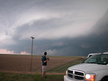
We started the day in Norman and traveled to Abilene, Tx. Towers began to go up along the warm front to our Northeast and we blasted to Breckenridge, Tx. The first storm moved north of the WF and died but the second one rode it, started to hook out and move Southeast. It chased us, along with 300 other chasers down to I-20 and began to weaken as it moved off of the WF and a 700mb warm air intrusion ate it. We observed many wall clouds but no tornadoes obviously. Northwesterly 500mb flow prevented this storm from sustaining a strong mesocyclone. The core prevented adequate inflow from reaching the meso that was located on the Northwest side of the storm. I still hate NW flow events! Beautiful storm though...


Subscribe to:
Post Comments (Atom)


6 comments:
Great shots man!
Sean,
Weather Gods Inc. was chasing on the same storm and has funnel clouds that occured on the same super cell pictured on its web site. The storm had a meso on the south side of the storm and was scud sucking and rotating rapidly. Hills and trees kept us from veiwing the storm for 85% of the time. When we were able to veiw it, there were multiple funnels produced.
Thanks
Mark Lingl
Weather Gods Inc. CEO
Weather Gods? Is this a joke?
No Joke, Look up the web site. weathergodsinc.oom After a quick search there were other chasers on the south side of the storm also. If you google the following you can see his pictures and account also. 5/5/09 tornado texas Bill@TornadoXtreme.com
Thanks
Mark Lingl
Weather Gods Inc.
We saw wallclouds with focused rotation, but no visible tornado. That does look like tornado damage but I cant say until NWS looks at it. Thank you for making me aware of the damage, as there seems to be little to no information regarding it. I see the damage but I cant see a tornado in Bill's images.
Sean,
When you read Bill's report on his chase, he says that he has other pictures of the storm, and he could not confirm that there was a tornado. Neither can I. The picture that he shows has a wall cloud in the background and a elephant trunk in the foreground. A funnel that twists toward the ground then up, then down towards a tree top. With that funnel and I have more pictures of funnels on the same storm. I can't confirm any touch downs either, but it was a rotating storm that was going for a while and we lost veiw of the cloud base for periods of time. I am just saying that it had a chance. Anyway, I will be out again on 5/16/09 for about 9 days with another tour group, I hope to see you out there.
Thanks
Mark Lingl
Weather Gods CEO
Post a Comment