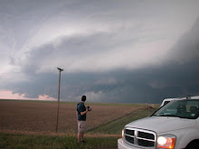
A really nice autmn severe weather episode appears to be in store for parts of Kansas tommorow. Unlike last week, the forecast models have remained consistant in depicting a really nice severe weather day. The cap will be an issue tommorow but we will be positioning our selves on the nose of a dry punch where airmasses are colliding. A 60-80 kt upper jet will begin to enter the area around 0z and hopefully will provide some decent forcing. Based on the latest NAM model guidance, I am inclined to target near Oakley Kansas. The Merage family and myself will be on the road by 11:00 a.m. tommorow morning. Jon Merage and I will also be staying out for sunday's potential setup in central KS or south central NE. Finally a decent chase opportunity!!!
If the cap breaks, this will be the most likely area for tornadoes

Surface based Cape approaches 2500 J/Kg

 Surface based Cape approaches 2500 J/Kg
 Surface based Cape approaches 2500 J/Kg
 Surface based Cape approaches 2500 J/Kg

No comments:
Post a Comment