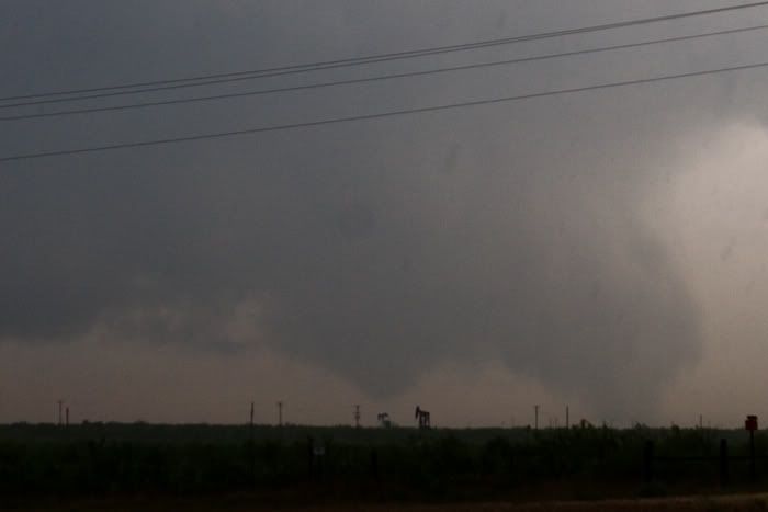
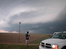
Holy Cow! What a year for tornadoes in Colorado.I Chased with Mark Farnik and Ben Toms today and we scored four tornadoes! Two near Deer Trail and two more 70 miles North, on the South side of Brush. We had a really nice boundary to play with and storms had a chance to produce only a few tornadoes before moving off the NE to SW oriented boundary. Very photogenic tornadoes!
Tornado near Gary Colorado, somewhere South of Brush
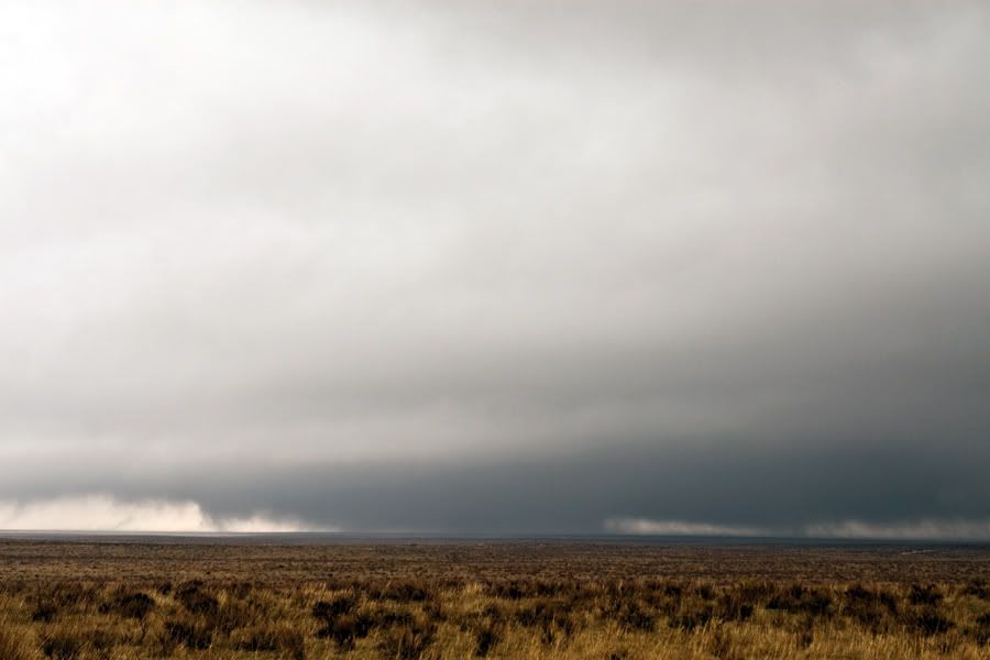
Possible tornado near Deer Trail
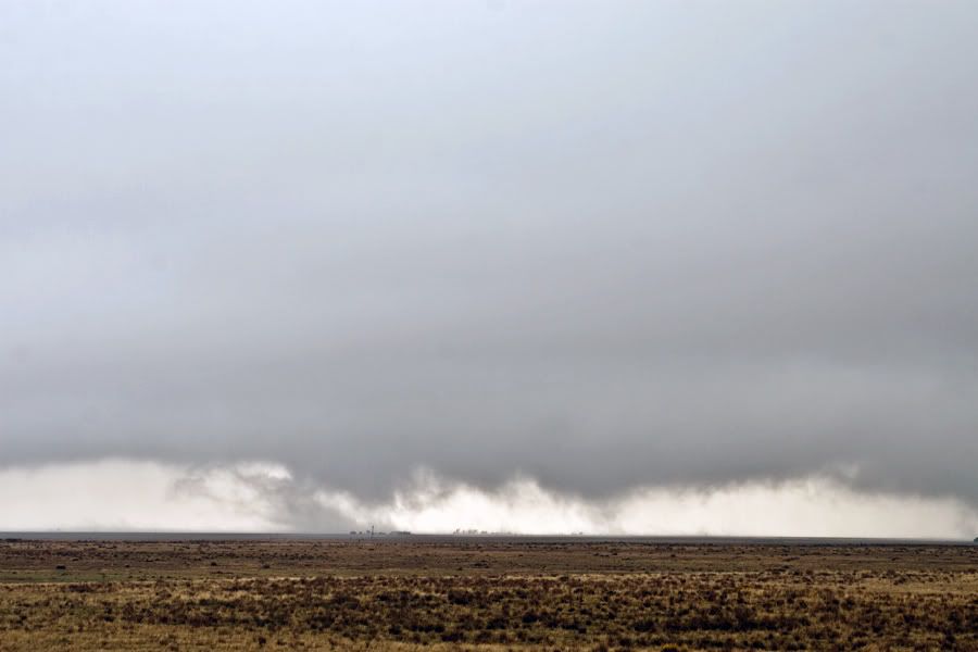
Debris from a tornado near Gary
Funnel aloft near Gary
Monday, August 16, 2010
Tuesday, July 6, 2010
June 10th Deer Trail Colorado Tornadoes
What an amazing day! Colorado has had a fantastic year for tornadoes. This more than made up for missing the Campo Tornadoes. After a series of cell mergers and interactions, this storm anchored on the southern end of the chain of supercells and spun like a top, dropping 3ish tornadoes.
I have seen tons of supercells but nothing compares to this symmetry! Tornado #1 ongoing.
Looks like we had a weak satellite circulation associated with Tornado #2
Tornado #2 looking epic.
I have seen tons of supercells but nothing compares to this symmetry! Tornado #1 ongoing.
Looks like we had a weak satellite circulation associated with Tornado #2
Tornado #2 looking epic.
June 21st Weak Tornado Near Yuma Colorado
Sorry for the lack of updates. Many more will be posted in the coming days. Had a solo chase on June 21st. I left late and core punched, emerging under the rain free base East of Brush. This brief tornado never fully condensed but I was able to confirm rotation at the cloudbase and on the ground. Yuma got smashed with baseball sized hail shortly after this. I called it a day and went back west to witness an awesome rainbow and sunlit towers.
Sunday, May 23, 2010
5/22 South Dakota Tornadoes Report!
Quite simply, this was the best chase of my life! Jon Merage and I were surprised to hear that V2 called a down day so we headed up North, towards Pierre South Dakota. A small patch of CU formed NE of Pierre and developed into a violent supercell. We watched the thing from birth till death. Fortunately, no injuries or deaths were reported but some unfortunate damage was done to farms north of Bowdle.
This storm had incredible structure! This is looking South from the North end of the Hook. Wrapping up so nicely, we just knew this was going to put down tornadoes.
An early tornado South of Highway 12, about 5 miles West of Bowdle. Not sure if this continued and developed into the wedge or not. It almost appeared to be the same circulation. We will have to go over the radar data.
After the tornado crossed Highway 12, we blasted East and turned North on Highway 47. I somehow managed to "click" this shot handheld from the driver's seat enroute to the wedge intercept. The storm really began to look plain nasty at this point.
So, we headed North on 47 and see this earth devouring beast of a tornado. This is at 10mm so it looks much further away.
And here is is at 20mm. Ears popping at this point as they did several times during the chase. The data from our mesonet should be very interesting.
Ok, this is the wedge grinding through a farm North of Bowdle on 47. Very scary moment here as a policeman appeared to drive directly into the circulation towards the damaged farmstead to check for survivors. Fortunately, he appeared a few moments later. No injuries were reported here despite the damage to the farmstead wich looks to be at least EF-3 in strength.
I will have a link up soon to the amazing footage that Jon Merage got. Be sure to stay tuned to that.
Saturday, May 22, 2010
May 22nd South Dakota Violent Tornadoes!
Massive Tornadoes in South Dakota today! Just a quickie here. Plenty more to come, trust me.
Tuesday, May 18, 2010
2010 Lightning Drought Comes to an End!
Today marked my first chase in New Mexico. We had a late start due to car complications and were unable to deploy with the rest of the V2 crew. We headed West as soon as the car was ready to go but V2 called off operations for the day before we could get to the storm. So we settled for some sunset lightning before heading to the hotel. Decent Lightning Finally!
We will deploy on tornadic storms tomorrow!
Friday, May 14, 2010
May 14th Texas Tornadoes
Vortex 2 had an amazingly succesful day in West Texas, intercepting at least 3 tornadoes south of Notrees Texas. The initial tornado was a large stovepipe from our view, followed by a large cone that never fully condensed, occuring simultainiously, followed by a thin tube that also did not condense fully, despite an obvious ground contact.
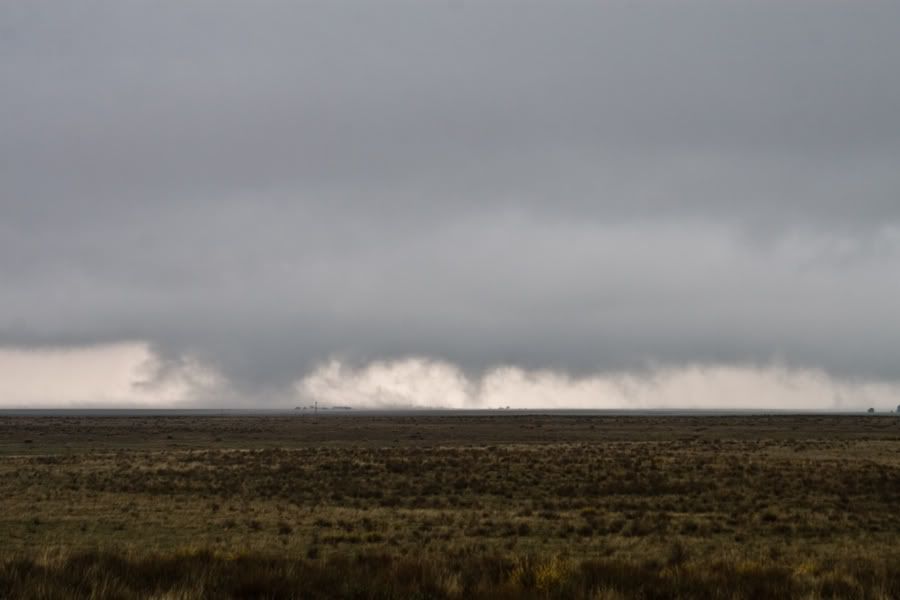
Lets start with tornado #3, considering its the only decent picture of a tornado I got all day.
Tornado #1 in progress with #2 forming to the left, starting as a cone.
Tornadoes #1 and #2 on the ground simultaniously.
Tornado #2 at mature stage.
Outflow dominant storm near Douro Texas on I-20.
We were well northeast of the first 2 tornadoes but had a very nice intercept on #3. Looking forward to going over the data. It was also a very scary day for Midland Texas, with several tornado warnings in the area and massive flooding.
May 10th Tornado Outbreak Report
Vortex 2 deployed on destructive tornadic supercells monday. We started the day with a plan of intercepting the storms as they moved E/NE from the I-35 urban corridor. We spent most of the day in Stroud Oklahoma, just Northeast of OKC. Storms fired and we dropped Southeast, ending up East of Seminole Oklahoma. Probe 8 intercepted a large tornado just north of the Highway 56/9 intersection. 22 tornadoes have been confirmed with widespread damage to several counties in Oklahoma and Kansas. 2 deaths were reported from this outbreak.
Paul Markowski, Associate Professor of Meteorology at Penn State briefs Vortex 2 participants about the action plan of the day.
Last minute repairs and modifications shortly before the chase.
The Vortex 2 Probe team awaiting initiation in Stroud Oklahoma.
Large tornado about to cross highway 56, just north of highway 9, East of Seminole.
Outflow dominant storm. This was the 2nd target storm of the day for V2.
Tornado damage on the north side of Seminole.
Monday was simply crazy, terrifying, and horrible, especially for the residents who were affected by these storms. Extremely fast storm motions and unfavorable terrain made a very difficult deployment for V2. Hopefully, our data collection efforts will prove valuable and further the cause to improve warning times and accuracy for the general public.
I have several more chase reports upcoming...
Sunday, April 25, 2010
April 22 Eads Colorado Tornadoes
Jon Merage and I got a late start out of Denver and blasted Southeast through Limon to just North of the Eads Colorado area. We had no data so I called Dan Cianca who told me a tornado warned storm was coming up from the South. Thanks Dude! We peaked a hill to see an elongated looking storm with several tornadoes on the ground!
We will have to do some video analysis to see how many different tornadoes we actually recorded. LCLs were very low and it was almost impossible to pick out separate mesocyclonic features. These tornadoes were occurring in an environment characterized by a 54/54 temp/dewpoint with incredible shear. We observed several multivortex tornadoes with assorted cones, trunks, and ropes, followed by a wedge. The storm seemed to die after the wedge so we headed into Southwest Kansas and caught a large tornado from a distance looking North from just West of Garden City Kansas.
Wednesday, February 24, 2010
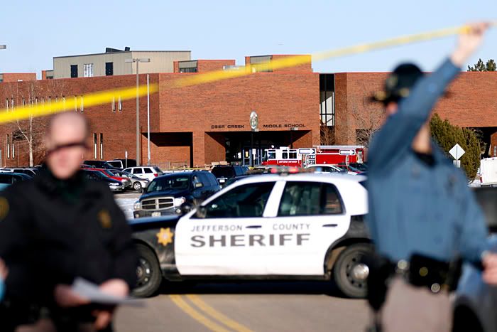
Deer Creek Shooting, Here We Go Again
Two schools, 11 years. Who would have thought it could happen again, let alone in the same neighborhood.
Jefferson County Sheriff's officers set up a roadblock near Deer Creek Middle School, where an unidentified man shot two students Tuesday. Photo by Sean Mullins . smullin5@mscd.edu
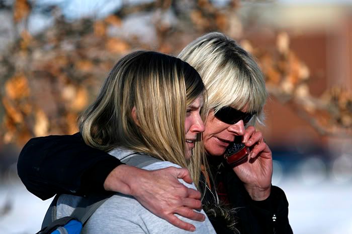
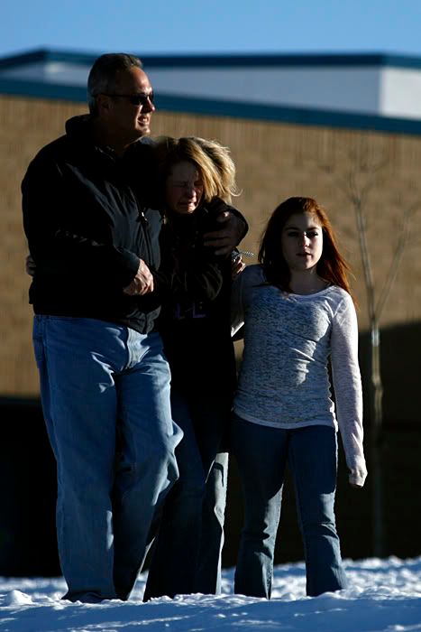
Mackenzie Owens, a Deer Creek student, is comforted by her mother shortly after the shooting. Owens said "I saw the shooting. We only heard one shot." Photo by Sean Mullins . smullin5@mscd.edu
Ashley Marcon, a Deer Creek Student, is comforted by her family shortly after the shooting at Deer Creek Middle School. Ashley's mother said "she saw the victims come into the room after the shooting." Photo by Sean Mullins . smullin5@mscd.edu
I was in 8th grade at Dear Creek during the Columbine shootings. Today is a jarring reminder that these things can happen anywhere, anytime.
Wednesday, February 10, 2010
Tuesday, February 9, 2010
Best of San Francisco 2009
This is pretty belated but oh well. Some keepers from my San Francisco trip last Fall.
Thursday, January 7, 2010
Twilight at Tillamook Bay
Happy New Year! I just returned from a fantastic trip to Oregon to see family and friends. Photography wasnt my top priority but I managed to get this shot during our one decent weather day on the Oregon coast.
This is looking NW from the pier at Garibaldi on the North side of Tillamook Bay. A 30 second exposure brought out nice saturated greys and blues while smoothing the water. The only post-processing was setting black and white points and sharpening.
Cheers and Happy New Year!
This is looking NW from the pier at Garibaldi on the North side of Tillamook Bay. A 30 second exposure brought out nice saturated greys and blues while smoothing the water. The only post-processing was setting black and white points and sharpening.
Cheers and Happy New Year!
Subscribe to:
Posts (Atom)