Howdy all! This is one of many projects from my recent San Francisco journey.
Please allow a few moments for the slide show to load. Also, pause the music at the bottom of my page if you wish to enjoy this with no distractions!
Any feedback is greatly appreciated.
Wednesday, October 21, 2009
Tuesday, September 29, 2009
Thursday, September 3, 2009
MSCD HipHop
I shot some promo stuff for MetRadio the other day and was pretty happy with the shots so I figured I would share a few.


Friday, August 14, 2009
Columbia River Gorge Redoux
Lower Ruckel Creek Falls, Columbia River Gorge, Oregon.

I screwed up the white balance and a few other things so here is a much better version of the original shot!
This waterfall is a pain in the ass to reach. We had to scramble 2 miles up a creek with tons of fallen trees and mosquitos. The trek was well worth it as we were greeted with really nice light. I tried to add to the atmosphere by breathing on the lens to get a little glow in the highlights(thanks to Marc Adamus for the tip!). This is the cliche composition, but I will post the others when I have more time. Goodnight from Manzanita, Oregon!
Thursday, June 18, 2009
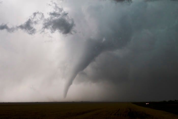
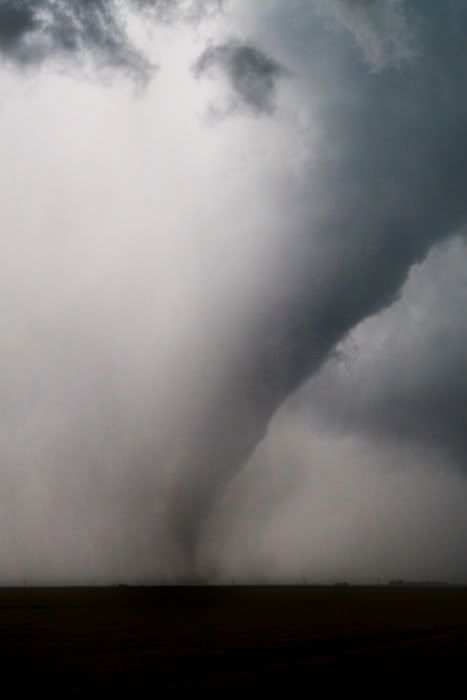
6/14/09 Belated Kansas Tornado
This was supposed to be the day before the day but ended up being the day! Our storm really looked like outflow crap but somehow managed to put down a short-lived tube. The tornado was in Haskell County, Ks. 2-3 miles west of the 144/83 intersection. There was no rope out stage. The tornado simply got destroyed by outflow lol! On a strange note, We bagged this tube the day after our obligations with V2 ended. Maybe there was a curse lol!


Casual Local Chase
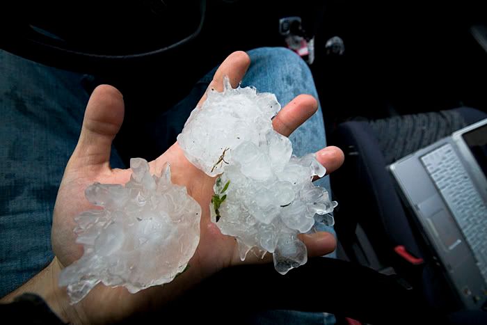
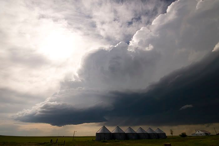
Headed east out of Denver today. I tracked the storm from Watkins to Yuma and had a blast. The storm tried hard to tornado near Otis and dropped some 3 inch hail north of Yuma. This structure early on was very nice, but I ended up with strange color casts from the Polarizer, which I am now ditching. Updates from the rest of the season are coming soon.


Saturday, June 13, 2009
Random Storms
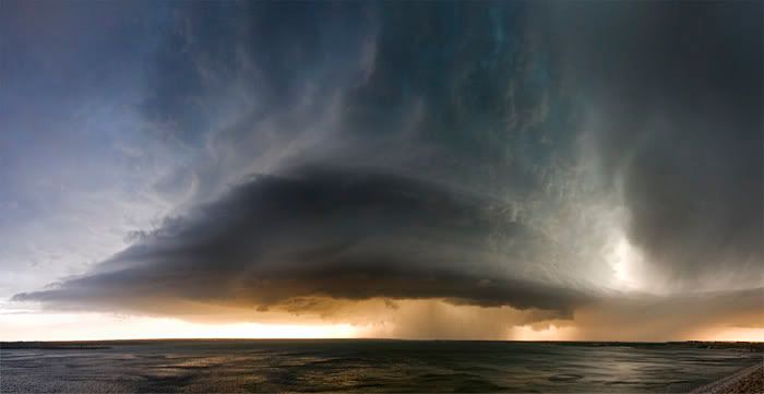
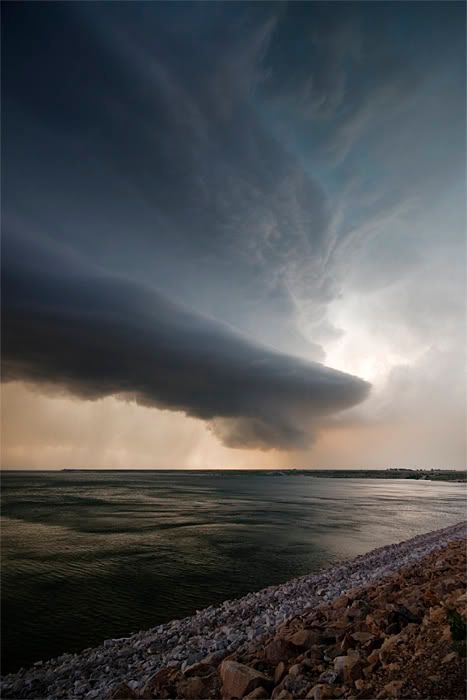
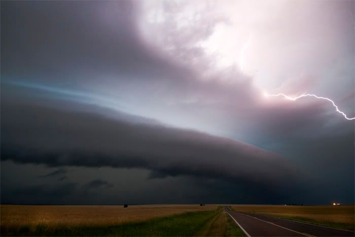
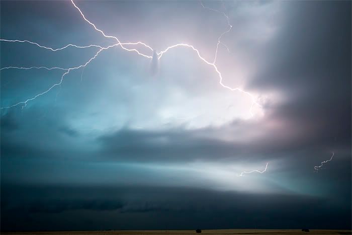
I'm so far behind with photos right now so here are a few random selections. The latter half of the Vortex 2 project has been a blast. Only one tornado, but great storms, structure, and science have made this effort plenty productive. I take comfort in the fact that we need to learn more about non-tornadic storms as well. Tomorrow is the last day of the project so we are hoping for one more tornado obviously. I have many more images that will be spewed fourth randomly over the coming weeks...


Sunday, June 7, 2009
Sand Hills Majesty
A marginal day with a storm that struggled with the cap and anemic surface flow. Probe 8 sampled atomized rain drops, only a few hundred feet south of the hail core. The storm briefly produced epic high based structure and 1.75 inch hail before interacting negatively with an outflow boundary and becoming elongated. We are looking forward to a great chase day tomorrow where boundaries will play a key role in tornadogenesis and associated V2 intercepts.
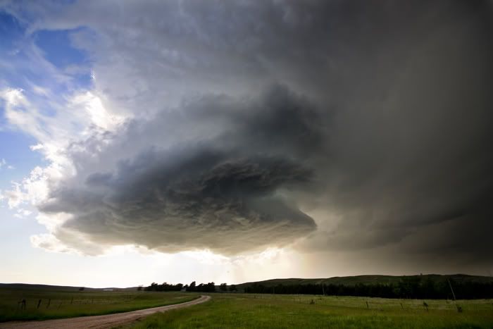
Regarding today's photography: I tried a new post processing workflow to increase the dynamic range of the scene. It is essentially an un-tonemapped HDR with a simple mask in the foreground. The improper use of a polarizer caused an unnatural color gradient in the sky but I am happy with the global saturation of the image. I will surely be exploring this technique again in the near future.
Scroll down for an epic tornado on the previous chase!
Saturday, June 6, 2009
High Plains Magic!
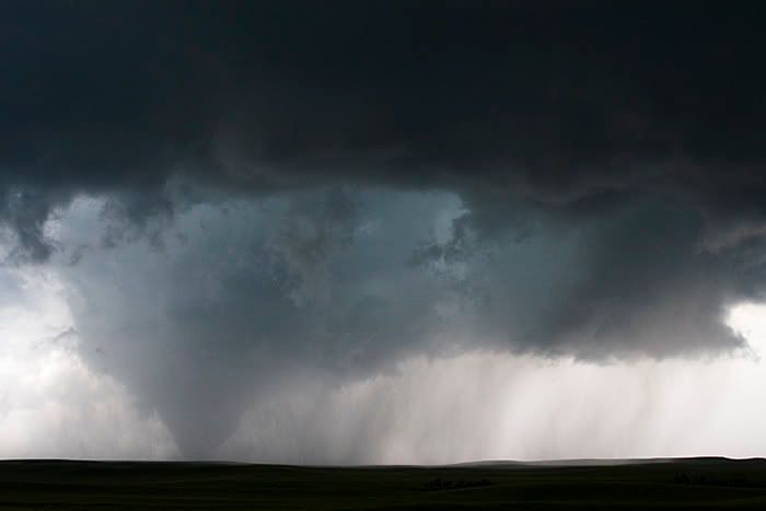
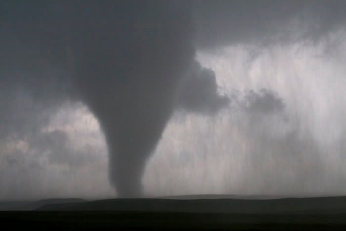
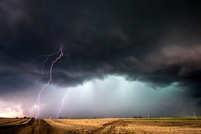
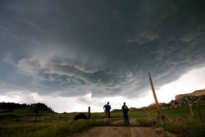
4 a.m. update lol. Im seeing crap from lack of sleep and I hope these pix are toned ok. Anyway, a quick edit here. Cant go into details obviously but I saw my first Wyoming tornado! V2 got a great dataset and Probe 8 sampled rotating rain curtains just prior to tornadogenesis!


Friday, June 5, 2009
Vortex 2 Random Stuff
Sorry for the lack of updates but all I wanna do after chasing is to sleep. Anyway, we have been roaming the plains for several weeks now with a nice break inbetween. The disdrometer ended up being screwed so we just have a mesonet now, which is better than nothing for sure lol. Had a decent chase today in the High Plains and damn near bagged a tube, but weak surface flow put the kiabosh on that. The weather is finally starting to shape up. We have several upcoming chase days over the weekend and next week. Im looking forward to collecting data in tornadic storms for once lol! Ill try and update more in the near future.
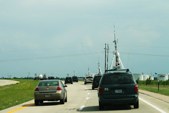
Probe #8 with nice storm!
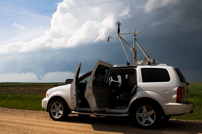
On the road again!
Jon Merage and Aaron Kennedy get SASSI up and running.
Jon Merage troubleshoots with the data logger, just before the heat of the chase.
This picture sums up the month of May for Vortex 2, but thats all about to change.
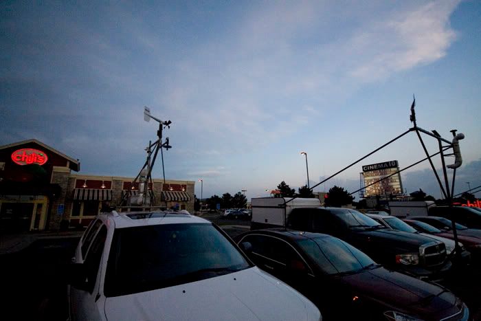
This one is for the Chili's Sw Plaza Crew. Miss yall!
Probe #8 with nice storm!

On the road again!

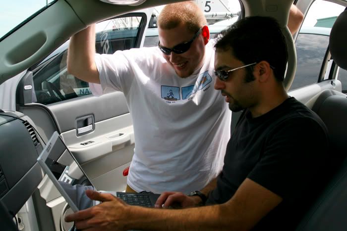
Jon Merage and Aaron Kennedy get SASSI up and running.

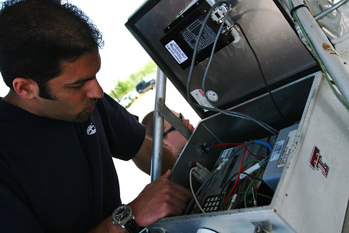
Jon Merage troubleshoots with the data logger, just before the heat of the chase.

This picture sums up the month of May for Vortex 2, but thats all about to change.

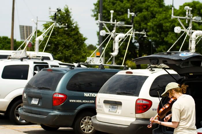
This one is for the Chili's Sw Plaza Crew. Miss yall!

Friday, May 15, 2009
Lightning and Disdrometers
We had a crappy chase on the 13th, missed tornadoes to our North and East, but managed to get some sick lightning. This storm was fierce! The lightning was purple and positive the whole time. No staccato here, just positive super plasma bolts lol!


In other news, we have attached the mesonet to the Durango, finally! We are also going to be attaching a torpedo sized Disdrometer, which allows us to measure drop size, distribution, and velocity of falling hydrometeors(rain or hail) while we are in motion. we are supposed to travel 38 mph taking readings with the Disdrometer. This thing is supposed to be mounted on aircraft so its pretty cool looking. To the best of my knowledge, we will be the only team in V2 with a Disdrometer capable of collecting data while we are in motion. So, its really awesome to have a unique research tool! Today appears to be the last good severe weather opportunity for several days. We will continue updating the vehicle and hopefully come back to Denver for a few days! Ill post some vehicle shots as soon as everything is completed.


In other news, we have attached the mesonet to the Durango, finally! We are also going to be attaching a torpedo sized Disdrometer, which allows us to measure drop size, distribution, and velocity of falling hydrometeors(rain or hail) while we are in motion. we are supposed to travel 38 mph taking readings with the Disdrometer. This thing is supposed to be mounted on aircraft so its pretty cool looking. To the best of my knowledge, we will be the only team in V2 with a Disdrometer capable of collecting data while we are in motion. So, its really awesome to have a unique research tool! Today appears to be the last good severe weather opportunity for several days. We will continue updating the vehicle and hopefully come back to Denver for a few days! Ill post some vehicle shots as soon as everything is completed.
Sunday, May 10, 2009
5/8/09 Texas Chase Report
100th blog post Woooo! Anyway, we intercepted this supercell just south of Saint Jo, Tx after a nice bbq dinner at the Rib Joint in Ardmore, Ok. We didn't have much hope for the day, but huge instability and marginal shear gave us some great structure and a possible tornado. Fires burning in Mexico made for a very hazy chase and wonderful sunset colors!

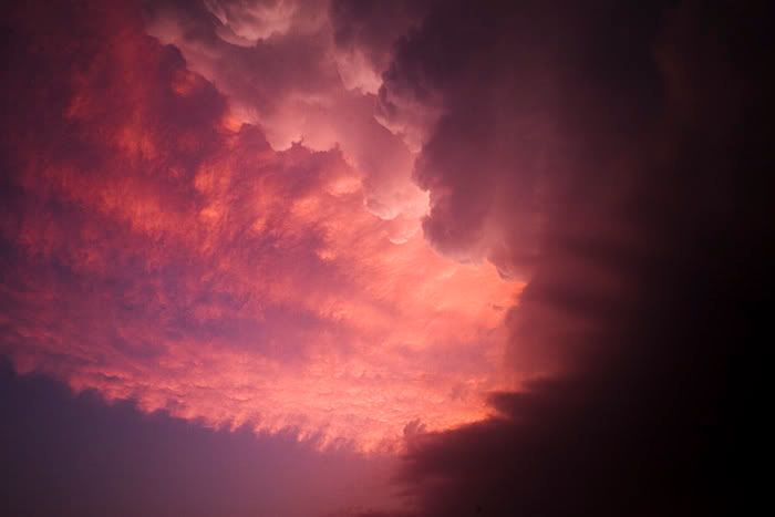


The above image was taken from Saint Jo, looking north at 9:53 p.m. Im not going to call this a tornado but it sure is damn tempting. I did have water on the lens so Im not discounting the fact that it could be an artifact or reflection. Anyway, a solid shear couplet was present at this time so... Opinions on this would be appreciated! Obviously, this image was globally edited heavily.


The above image was taken from Saint Jo, looking north at 9:53 p.m. Im not going to call this a tornado but it sure is damn tempting. I did have water on the lens so Im not discounting the fact that it could be an artifact or reflection. Anyway, a solid shear couplet was present at this time so... Opinions on this would be appreciated! Obviously, this image was globally edited heavily.
Wednesday, May 6, 2009
5/5/09 Texas Chase Report
We started the day in Norman and traveled to Abilene, Tx. Towers began to go up along the warm front to our Northeast and we blasted to Breckenridge, Tx. The first storm moved north of the WF and died but the second one rode it, started to hook out and move Southeast. It chased us, along with 300 other chasers down to I-20 and began to weaken as it moved off of the WF and a 700mb warm air intrusion ate it. We observed many wall clouds but no tornadoes obviously. Northwesterly 500mb flow prevented this storm from sustaining a strong mesocyclone. The core prevented adequate inflow from reaching the meso that was located on the Northwest side of the storm. I still hate NW flow events! Beautiful storm though...


Monday, May 4, 2009
A Dying Storm and Thoughts on Tommorow
We chased May 1st in North Texas and saw the storms near the Seymour area. Nothing too photogenic untill the storm began to die. Im really digging the files the 30D produces, as long as I dont underexpose lol!

Regarding tommorow's chase potential: Im on the fence with this one but we are so close to the target area, Im not sure I could turn it down. The cap looks to be quite strong, but this could be a good thing if we can get one isolated storm. Low level shear looks pretty good, despite the upper level winds causing venting over the inflow. LCLs could be crappy with 25-30 degree spreads but will improve as storms move away from the heat axis. Im sure if we get a storm, it will be impressive, just not sure about tornadoes as of yet. If the NAM holds true, Im looking at a target on I-20 between Sweetwater and Abilene.

Regarding tommorow's chase potential: Im on the fence with this one but we are so close to the target area, Im not sure I could turn it down. The cap looks to be quite strong, but this could be a good thing if we can get one isolated storm. Low level shear looks pretty good, despite the upper level winds causing venting over the inflow. LCLs could be crappy with 25-30 degree spreads but will improve as storms move away from the heat axis. Im sure if we get a storm, it will be impressive, just not sure about tornadoes as of yet. If the NAM holds true, Im looking at a target on I-20 between Sweetwater and Abilene.
Friday, May 1, 2009
Chasing North Texas Tommorow!
Bedding down in Norman, Oklahoma for the night. Targeting near the triple point in North Texas, likely near Seymour or Throckmorton. H5 winds look marginal but the WRF throws a 45kt impulse right over the triple point at 0z, we will see lol. Anyway, the 4km WRF shows one booming supercell with a hook in our target area. It will be nice to wake up so close to the target!
Thursday, April 30, 2009
Chasing Today
We are leaving a little late but Im sure we can make Northern Oklahoma well before dark. We will drop south from Hays, Ks and see if we can get some OFBs working for us. After the chase, we will head to Norman, Ok. where we will spend the next 10 days prepping Jon's vehicle before the madness begins. Stay tuned!
Wednesday, April 29, 2009
Meh...
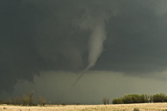
April 26th, 2009 will go down in my mind as a failure, despite seeing a tornado. Our targeting was good and we got on the Roger Mills County storm to see the first tornado. We should have continued north to see the next, larger, tornado form near the Canadien river, but we decided to blast South to more discreet cells coming up from the Red River. My photos simply suck and are horribly underexposed but here is a few anyway. I will post a report and better pix from the non-tornadic storms on the 25th when I get more time.



Saturday, April 25, 2009
Big Time Tornado Potential!
Sitting in Amarillo and after a nice lunch at Chili's will head to the Shamrock Tx area. Today is looking impressive with huge helicity values and higher dewpoints than forecast. Upper and mid level winds look to favor manigable storm motions! Check for twitter updates.
Friday, April 24, 2009
Chasing Saturday and Sunday
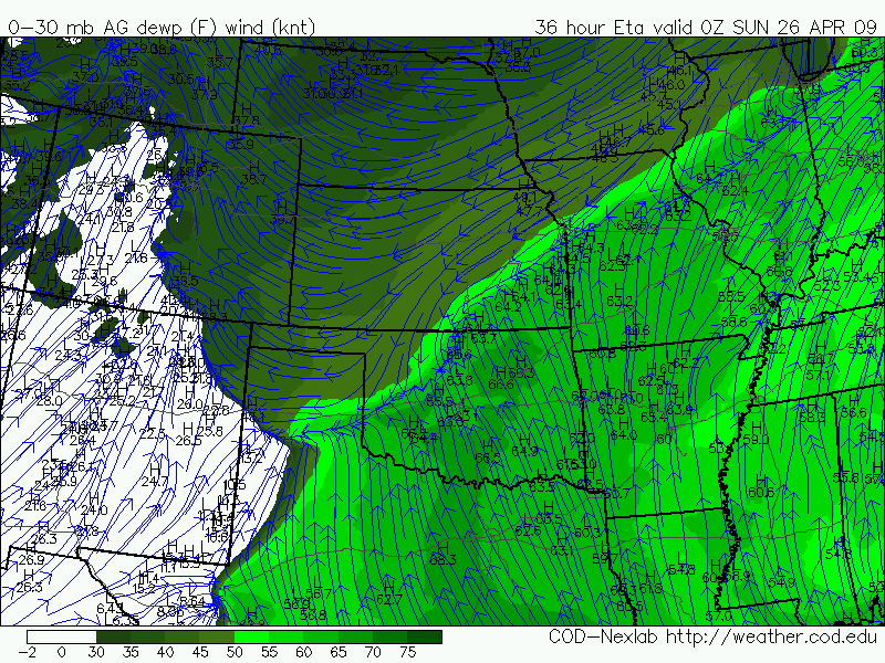
Im heading to Amarillo, Tx tonight for a couple of nice looking chase days. The GFS and NAM still differ regarding the placement of surface features, so I will go with a blend of the two, which looks like the Eastern Texas panhandle, into Western Oklahoma. Im alittle unsure about the target for Sunday, but I imagine it may be slightly further south than than Saturday. Stay tuned and watch my twitter for updates.

Tuesday, April 21, 2009
Candlelight Vigil for Columbine

Photo by SEAN MULLINS/smullins.photo@gmail.com
LITTLETON, CO - Hundreds of people gathered Sunday, on the 10th anniversary of the Columbine shooting, to mourn the loss of the 13 students and faculty who were killed in the attack.

Photo by SEAN MULLINS/smullins.photo@gmail.com
LITTLETON, CO - The family of Dave Sanders gather to celebrate his life during a candlelight vigil at the Columbine Memorial on Sunday, April 19, 2009. Sanders, a faculty member at Columbine, was killed during the attack on April 20, 1999.

Photo by SEAN MULLINS/smullins.photo@gmail.com
LITTLETON, CO - Mourners gather at the top of the Columbine Memorial during a candlelight vigil on Sunday, April 19, 2009.

Photo by SEAN MULLINS/smullins.photo@gmail.com
LITTLETON, CO - Maggie and Elizabeth Hickman mourn the deaths of the 13 Columbine students and faculty during a candlelight vigil on Sunday, April 19, 2009. One day before the 10th anniversary of the deadly shooting.

Photo by SEAN MULLINS/smullins.photo@gmail.com
LITTLETON, CO - A candlelight vigil was held on Sunday, April 19, 2009. At the Columbine Memorial, to remember the 13 students and faculty who perished during the school shooting.
Opinionated Discussion: This was one of the more emotional stories I have covered. The Columbine massacre happened shortly after my family moved to Colorado from Oregon, and only a year after "Kip" Kinkel went on a rampage at Thurston High School, in Springfield Oregon. These unfortunate events had my family taking a second look at inserting me into the public curriculum here in Littleton. It was very important for me to get out and document this event, and I feel it is necessary for everyone to be reminded of what took place here, not only for safety awareness but for the families that continue to suffer from their losses. My thoughts are with all who suffered in this tragedy. You will never be forgotten!
Self Critique: I have become quite rusty with the PJ stuff over the past few months. Gosh, the last thing I covered was the MLK Parade. Anyway, it was a pretty tough setting. Emotions were running high and the amount of PJs was clearly upsetting some people. Its our job to tell these stories and every PJ at the event was quite respectful, even when the Sanders family asked a few PJs to stop taking pictures. My frames are just ok with the exception of the Hill shot which I really like because of the layering. It was my first candlelight vigil so I did learn quite a bit. I was able to get away with 1600 ISO, which was good, and I didn't even have to put the 50 on like I planned. If I could do it again, a wide, fast prime like a 24mm 1.4 would be perfect. I feel my pictures lack that identifiable Columbine aspect, such as someone wearing a Columbine shirt with a candle or the school in the background or something to that effect. lessons learned and will nail it next time.
Sean
Wednesday, April 15, 2009
Preliminary Target For Thursday
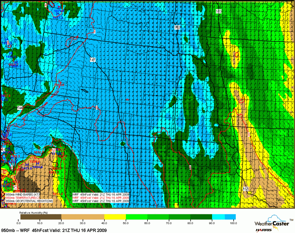
Kit Carson County is my pick for an isolated supercell around 21Z, on the nose of what appears to be a small dry-punch feature. Only a brief window of opportunity will exist for tornadic potential as heating and instability will obviously be quite limited. I'm encouraged by an STP of 5 and and dews approaching 50, which is doable by high plains standards, especially considering the low LCLs created by small Temp/Dp spreads. Anyway, it should make for a great lightshow at least.

Thursday, March 26, 2009
Belated 3/23 Chase Report
We had a nice cloudy drive to Wichita on Sunday and woke up in the target area Monday morning. We intercepted our first supercell near Kingman, Ks but it quickly left us in the dust as it appeared to be on the verge of tornadoing somewhere near Cheney Reservoir. We drove back to Wichita and south on I-35 as storms were beginning to erupt in northern Oklahoma way too early. We got position on the dominant supercell just east of South Haven, Ks. The storm was rather elongated but managed to produce a few brief tornadoes. Overall, the setup failed to meet our expectations but we had a nice go of it for the first chase of 2009.


In other news, it appears we are in for some heavy snow here in Western Littleton. I'm looking for 15-20 inches here at the house before all is set and done. I will possibly be shooting some heavy snow action tomorrow. Look for winter weather updates.


In other news, it appears we are in for some heavy snow here in Western Littleton. I'm looking for 15-20 inches here at the house before all is set and done. I will possibly be shooting some heavy snow action tomorrow. Look for winter weather updates.
Subscribe to:
Comments (Atom)
