Thursday, June 26, 2008

Ken-Caryl Valley Storm 6/25/08


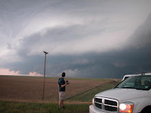
What a nice suprise! A sweet, photogenic storm went up over the Ken-Caryl Valley right at sunset. This thing had cool structure and awesome lightning. The first shots are in my hood and the last one is out at Castle Pines Pkwy and I-25. Im really happy with these shots! This will help ease the pain of having to miss tommorow's tornadic setup in South Dakota.
Monday, June 23, 2008

Ducking For Cover!

This was taken somewhere south of Wichita, Ks. On June 12th.

Jon and I were both ducking for cover as this struck about 50 yards from us. The photo was taken at 10mm so it looks further away than it really was. I was really lucky to be stopped down and have the shutter open at this point. June 12th was a frustrating day with a cold front crashing through the area. We had all but given up home. we were hunting for a place to get dinner in Wichita as a huge supercell formed right over the southern part of the city. We were unable to get east of the hook due to traffic, street flooding, and road construction. More supercells formed to the southwest and we were able to intercept these after dark for some killer lightning. The bulk of my chasing this season is behind me. I will save my money for the outbreaks in August and September barring a potent tornadic setup closer to home. I will continue to shoot storms and lightning in the Denver area throughout the summer.

Monday, June 9, 2008

5/22-5/24 NEW VIDS!!!

Here is the video courtesy of Jon Merage. His video and editing skills are fantastic and these vids bring justice to these tornadoes like no photograph can do.

Multiple tornadoes near Orlando, Ok. on the 24th!


Hoxie, Ks. Multivortex madness on the 22nd!

More of Jon's videos can be found at:
http://www.youtube.com/user/jmchaser